
HDS – Why photogrammetry is becoming a core tool in highways and construction
 Jack Moriarty Posted On May 29, 2026

Photogrammetry has become a widely adopted method for capturing accurate survey data across highways and construction projects.
By processing overlapping aerial images into detailed 3D models and mapping outputs, the technique is helping project teams improve efficiency, reduce site disruption, and enhance the quality of decision-making.
In an industry where time on the network, safety exposure, and data accuracy are critical, photogrammetry is increasingly being used as an alternative to traditional ground-based survey methods. Its ability to capture large areas quickly and produce repeatable digital records has made it particularly relevant to infrastructure delivery and asset management.
Faster and Safer Highway Condition Surveys
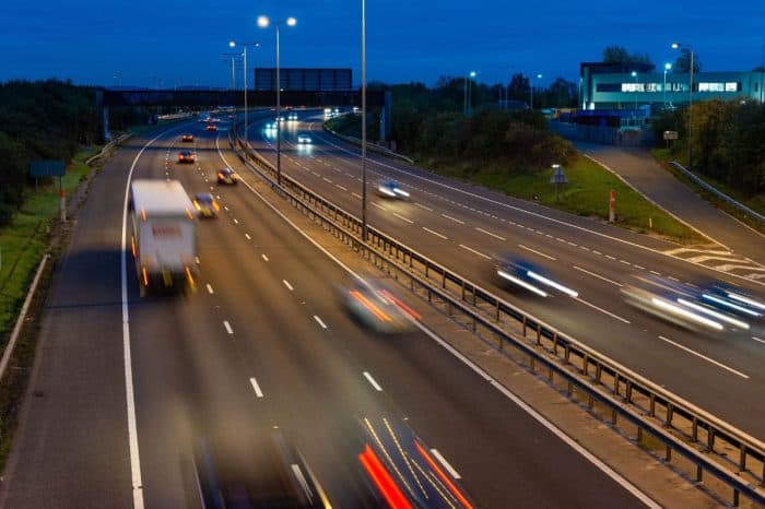
One of the key applications of photogrammetry in highways is surface condition assessment. High-resolution aerial imagery allows engineers to review carriageway surfaces, joints, and defects without the need for personnel to work in live traffic environments.
For maintenance and resurfacing schemes, this approach reduces reliance on walking inspections and lane-based observations. It also provides a consistent visual record that can be reviewed by multiple stakeholders, improving collaboration between design, delivery, and asset management teams.
Reliable Volume Measurement for Earthworks
Photogrammetry is also widely used for volume calculations across construction sites. By generating accurate surface models, it enables reliable measurement of cut and fill operations, stockpiles, and material movement.
This reduces the need for manual measurement techniques such as tape surveys or isolated GPS checks. It also allows quantities to be revalidated at different stages of a project, supporting better cost control and progress tracking.
Improved Site Layout and Depot Mapping
Depot areas, compounds, and maintenance yards often change rapidly during active works. Photogrammetry provides an efficient way to produce up-to-date digital layouts that reflect current site conditions.
These datasets are used to support planning, access management, and asset coordination, reducing the need for repeated walkover surveys and manual sketching that can quickly become outdated.
Supporting Temporary Works and Construction Planning
Temporary works design and site logistics planning also benefit from accurate aerial models. Welfare facilities, plant locations, material storage areas, and access routes can be assessed using current site data rather than assumptions based on older drawings or incomplete surveys.
This helps reduce clashes on site, improves safety planning, and limits the need for additional site visits during the planning stage.
Safer Asset Inspection from Aerial Perspectives
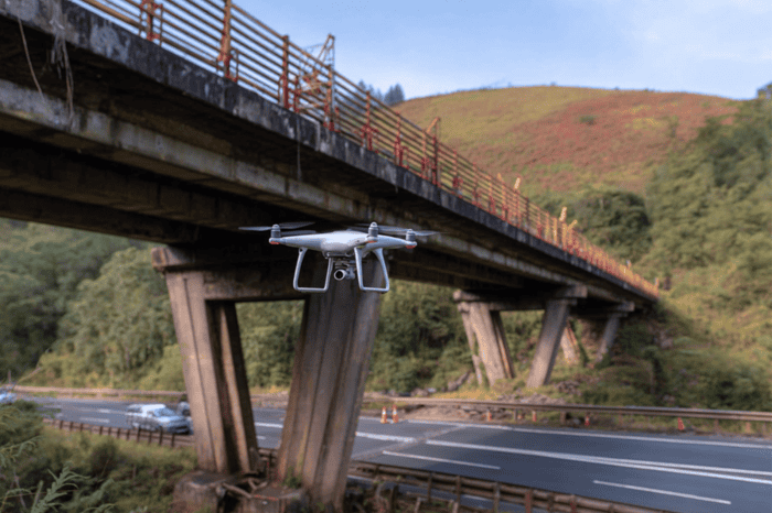
Photogrammetry is increasingly used for visual inspection of highway assets such as lighting columns, signage, gantries, and structures. Aerial perspectives provide consistent viewing angles that are often difficult or unsafe to achieve from ground level.
In many cases, this reduces the requirement for MEWPs, lane closures, or other disruptive access arrangements during early-stage inspections, allowing engineers to identify issues before committing to more intrusive survey methods.
Design Verification and As-Built Validation
Another important use case is the comparison of design intent against constructed reality. Photogrammetry datasets allow engineers to check alignments, clearances, and installation accuracy against project drawings or digital models.
This process supports faster validation during handover stages and provides a reliable record for quality assurance and future reference.
More Consistent Progress Monitoring
Traditional site photography often lacks consistency, making it difficult to track change over time. Repeat photogrammetry surveys create structured, time-based visual datasets that show how a site develops throughout construction.
These outputs are increasingly used to support reporting, payment applications, and dispute resolution by providing measurable visual evidence of progress rather than isolated images.
Reducing Time on Site While Improving Data Quality
Across highways and construction, photogrammetry is increasingly replacing a range of manual processes, including walking inspections, ad hoc measurements, and intermittent progress photography.
Its growing adoption is driven by three main factors: reduced time on site, improved safety outcomes, and the ability to generate reusable, high-quality digital data. As infrastructure projects continue to demand greater efficiency and accountability, photogrammetry is expected to remain a key part of modern surveying and project delivery workflows.
Explore more: Visit our Surveys and Data section for accurate data collection on infrastructure. Covering topographical surveys, GPR, utility mapping, and digital twin technology. .
Stay sharp
Never miss a story
The daily highways digest, straight to your mailbox.
You will get a confirmation email. Unsubscribe anytime. About The Highways Industry Newsletter →